
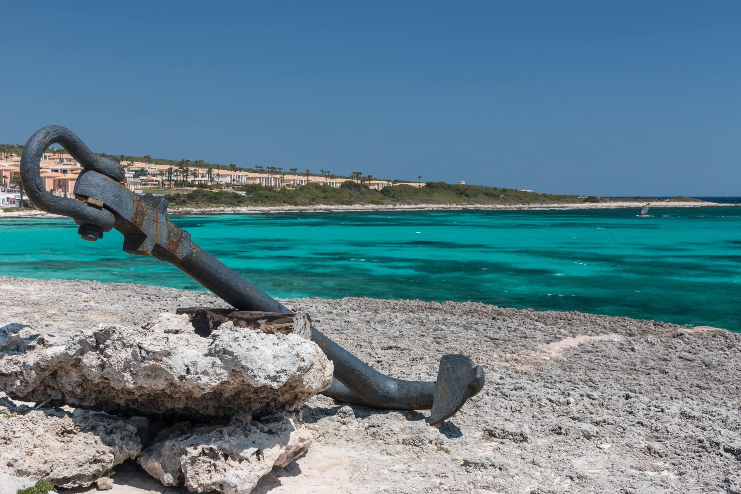
Spain’s Enclaves, Exclaves and Territories
We’ve traveled quite a bit around Spain in years past, but still need to check out a few parts of the Spanish mainland such as southwest Murcia, the La Mancha area and the southwest around Cadiz. Once we are in Spain permanently, we’re looking forward to doing a lot of those trips and going back to areas we’ve been to before to stay longer and explore further.
Doing some early research, there are also other areas of Spain that are, surprise, surprise, not in Spain itself. That will be even more of an adventure and at looking at that list, probably not top of mind for most travelers when visiting Spain. We wanted to share our research here so maybe you can include them in your upcoming travel plans, too!
Spain in Africa: Ceuta and Melilla
Ceuta and Melilla are Spanish cities located on the northern coast of Morocco. Even though they’re on the African continent they are part of Spain and the EU. Residents use the Euro, vote in Spanish elections and receive full Spanish benefits and public services.
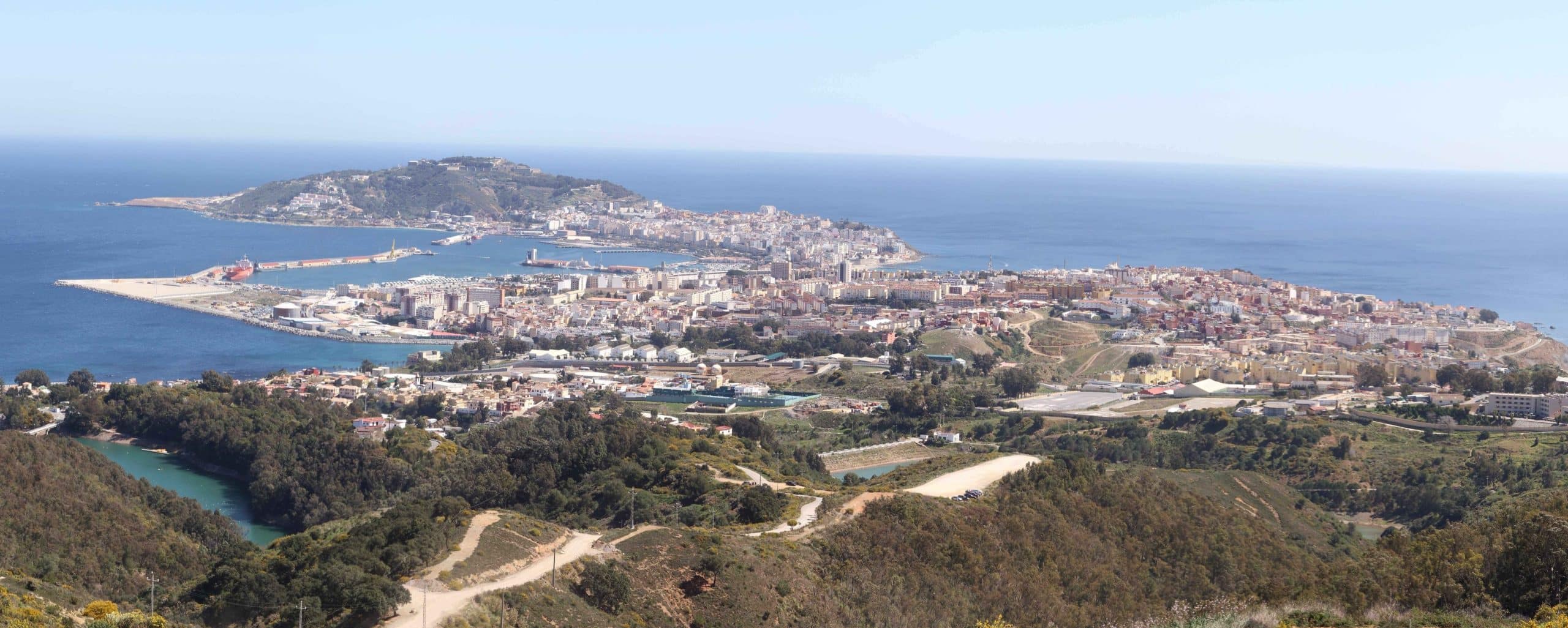
Ceuta lies just across the Strait of Gibraltar and Melilla sits roughly 250 km (150 mi) farther east along Morocco’s Mediterranean coast. Both have been under Spanish (or prior Portuguese) control since the 15th century and operate under special customs arrangements compared to mainland Spain.
Ceuta
Ceuta sits at the point where the Atlantic meets the Mediterranean and two continents face each other across the Strait of Gibraltar. The Royal Walls are the main sight to see. They are an ancient fortification with a navigable moat you can explore by kayak. César Manrique’s Mediterranean Maritime Park, right in the city center, offers saltwater pools, palm trees and restaurants for a leisurely afternoon. The waters here are rated highly by divers dueto the constant mixing of two seas.
Worth knowing: Ceuta has a lower tax rate than mainland Spain so shopping is noticeably cheaper. It works well as a day trip from the Costa del Sol, but guides say an overnight stay gives you more time to fully experience it.
Melilla
After Barcelona, Melilla has the second-largest collection of Modernist architecture in Spain. It’s the result of prolific architect, Enrique Nieto, a student of Gaudí who redesigned much of the city in the early 1900s. The old fortified city, Melilla la Vieja, sits on a hilltop above the sea and contains several small museums worth an hour or two. The diverse food choices reflect the city’s mix of Spanish, Moroccan, Jewish, and Hindu influences. Restaurants serving tapas, seafood, lamb with couscous, and mint tea are often found side by side. Melilla sees far fewer tourists than Ceuta which makes it feel more authentic and unhurried. Guides say to plan at least one night, ideally two.
Getting To Ceuta and Melilla
Ceuta is the easier of the two to reach. The Algeciras ferry takes about an hour and runs up to 20 times daily. It costs around €30 to €35 and you can bring a car. Algeciras is just a two-hour drive from Málaga making it an easy day trip from the Costa del Sol. There’s no direct flight.
Melilla is a longer haul. Ferries run from Málaga (7 hours), Almería (6.5 hours), and Motril (4.5 hours) with overnight options available. Fares start around €38. Flying can be more practical with direct flights from Madrid, Barcelona, Málaga, Sevilla, and Almería to Melilla’s small airport, just over 4km (2 mi) from the city itself.
The Islands: Canaries and Balearics
The Canary Islands lie about 100 kilometers (60 miles) off of northwest Africa and are closer to Africa than Europe. Tenerife, Gran Canaria, Lanzarote and Fuerteventura are four the eight total islands that are most well known.
The Balearic Islands are an archipelago of four main islands — Mallorca, Menorca, Ibiza, and Formentera — scattered across the western Mediterranean just off the eastern coast of Spain, roughly opposite Valencia and Barcelona.
The Canary Islands
Tenerife
Tenerife is the largest island with a unique volcanic legacy. Teide, Spain’s highest peak dominates the island from its national park and is sometimes dusted with snow. Tenerife offers world-class whale-watching, black sand beaches, a thriving food scene and the second-largest carnival on the planet. Puerto de la Cruz in the north offers colonial architecture and a more authentic Canarian feel.
Gran Canaria
Gran Canaria is often called the “miniature continent” that offers a little bit of everything — from volcanic peaks to desert-like dunes. The Maspalomas dunes in the south create a desert-meets-ocean landscape. The capital, Las Palmas, is one of Spain’s most exciting food cities. The island holds more traces of its indigenous Guanche inhabitants than anywhere else in the archipelago.
Lanzarote
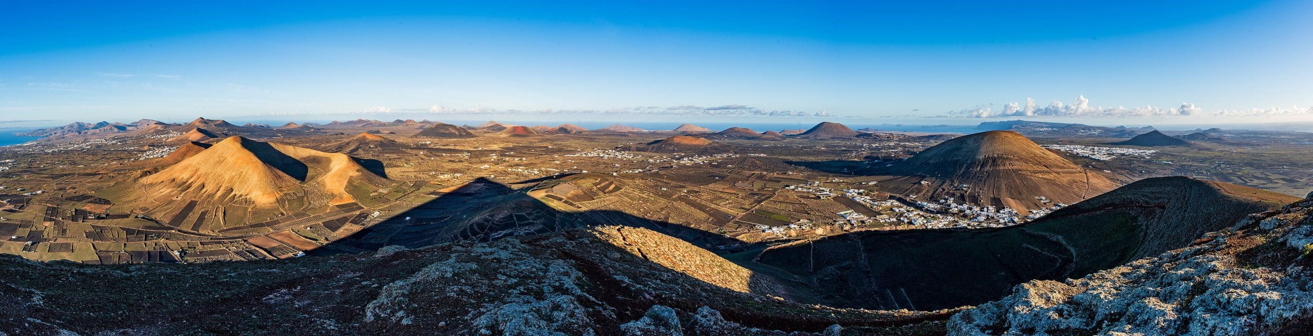
Lanzarote feels like another planet. Timanfaya National Park is filled with geothermal activity and the on-site restaurant uses it to cook food over a natural volcanic grill. The volcanic eruptions of the 1730s gave the island mineral-rich soil ideal for grape growing and the wines are well worth seeking out.
Fuerteventura
Just 60 miles from the African coast, Fuerteventura’s golden beaches and largely undeveloped landscape make it a paradise for beach lovers. The almost constant trade winds make it one of the world’s top destinations for windsurfing and kitesurfing.
La Palma
Known as La Isla Bonita, La Palma is one of the least visited Canary Islands but one of the most beautiful. Its skies are so clear that the entire island is a UNESCO Starlight Reserve. Artificial light is heavily restricted to protect the night sky. Dense laurel forests, volcanic calderas and steep sea cliffs make it a hiker’s dream. In 2021 when the Cumbre Vieja volcano erupted it reshaped part of the southwestern coast.
La Gomera
La Gomera is small, steep and largely untouched. Its crown jewel is Garajonay National Park, a UNESCO World Heritage site with a laurel forest permanently shrouded in mist unlike anywhere else in Europe. The island is also home to Silbo Gomero. It’s an ancient whistled language once used to communicate across its deep ravines which is still taught in local schools.
El Hierro
El Hierro is the smallest and most remote of the islands. It is the spot where Columbus left Europe. It’s almost untouched by tourism and is the first island to achieve 100% sustainability using only renewable energy. Its rugged cliffs, volcanic tide pools and pristine underwater world make it one of the Atlantic’s best diving destinations.
La Graciosa
Only officially recognized as the eighth Canary Island in 2018, La Graciosa covers just 29 square kilometers (18 square miles). It has some of the most beautiful beaches in the entire archipelago. It doesn’t have paved roads, cars, resorts or mass tourism. It’s part of the EUs largest marine reserve and has the most diverse marine life in the Canary Islands. The yellow cone of Montaña Amarilla and white sands of Playa de las Conchas are spectacular.
Getting to the Canary Islands
The Canary Islands have excellent air connections from practically any point in the EU taking around five hours (about three from mainland Spain). All eight islands have airports with most traffic flowing through Gran Canaria, Tenerife South, Lanzarote, and Fuerteventura. From the US, there are no direct route so travelers connect via Madrid or Barcelona.
Frequent ferries connect the islands with times ranging from 35 minutes to a few hours. Most allow you to bring your vehicle. Inter-island flights are also plentiful.
The Balearics
Mallorca
The capital of Palma on Mallorca is home to a number of architectural landmarks including the Gothic Santa María cathedral and the Arab fortress of Almudaina. The Tramuntana mountains are great for outdoor activities. Bike along numerous coastal and inland paths or hike through olive groves along the Ruta de Pedra en Sec. It’s a long-distance trail following restored medieval paths. Mallorca is the only wine-producing island in the Balearics.
Ibiza
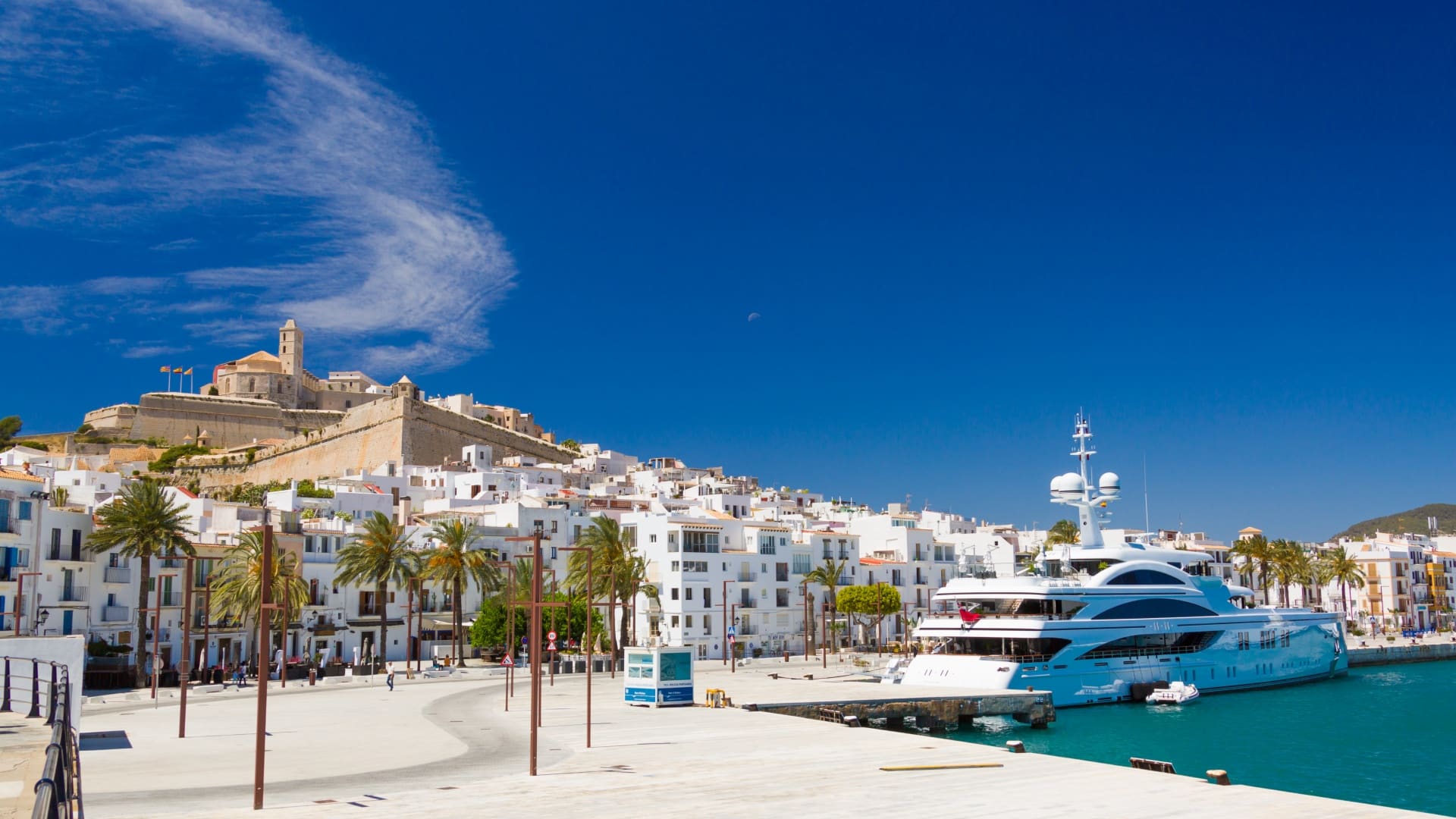
Ibiza is wholly unique. Its capital, Ibiza Town mixes historic sites with a hip nightlife, drawing clubbers and LGBTQ+ travelers from around the world. Head inland to rural escapes, designer accommodations and farm-to-table restaurants that feel far from the lights and techno of Ibiza Town. History buffs will find the UNESCO hillside town of Dalt Vila above Ibiza Town a prime example of Renaissance military architecture.
Formentera
Formentera is the smallest of the Balearics. It’s slower and rustic. Playa de Ses Illetes frequently tops “best beaches in the world” lists with its pristine white sand and shallow turquoise waters. The island has no mass tourism infrastructure to speak of. It’s largely untouched with only a select few luxury hotels and high-end restaurants, Formentera is small enough to explore entirely by bicycle. Its flat terrain makes it one of the most pleasant cycling destinations in Spain.
Menorca
Menorca is the place to go for a more relaxed vibe. Its 216km (120 mi) coastline is sprinkled with golden sand beaches and rocky coves called “calas”. It was granted UNESCO Biosphere Reserve status in 1993. Menorca boasts more beaches than Mallorca and Ibiza combined. Prehistoric Talayotic stone monuments dot the landscape. Menorcans were inspired into gin-making by the British during their period of occupation. Xoriguer gin (one of our absolute favorite gins, especially for spanish style G&Ts) is made in Maó and is often drunk as a pomada with lemonade.
Getting To The Balearics
Mallorca’s Palma de Mallorca Airport (PMI) is the island’s main gateway with flights from most major EU cities. Menorca Airport (MAH) and Ibiza Airport (IBZ) both handle domestic Spanish and international EU flights. Formentera has no airport. To reach it, fly into Ibiza and take regularly scheduled ferries.
Major ferry carriers offer various overnight routes from mainland cities like Barcelona, Valencia, and Dénia to the four main Balearic islands. Many operate daily. In winter, only Mallorca is really well connected by air, so those visiting the smaller islands in the off-season should plan accordingly.
Once on the islands, inter-island ferry connections are frequent and easy: Ibiza to Formentera takes just 30 minutes to an hour with more than 35 daily crossings. The Mallorca-to-Menorca crossing takes about 1 hour 15 minutes. Renting a car is the best way to explore Mallorca and Menorca. Ibiza suits scooters in high season and Formentera is ideally explored by bicycle.
The Plazas de Soberanía
These three are the most obscure and fascinating of Spain’s North African territories — tiny, remote and largely unknown even to many Spanish people. None of them have civilian populations to speak of and none are accessible to the general public. It makes them more curiosity than destination — but they’re genuinely extraordinary pieces of geography and history.
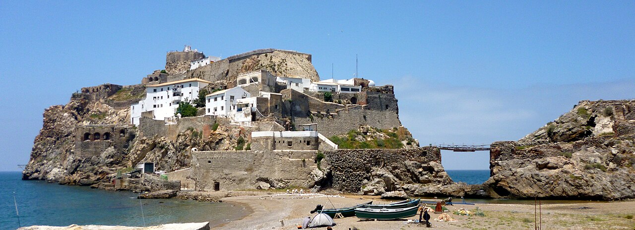
The Peñón de Vélez de la Gomera is a dramatic rocky islet that was once a true island. It’s now connected to the Moroccan mainland by a narrow sandbar created after a storm in 1934. It technically makes it the world’s shortest land border at just 85 meters (278 feet) long. It has been in Spanish hands since the 16th century and functions as a small military garrison. Its sheer cliffs rise directly from the sea and the whole thing is barely large enough to support the handful of soldiers stationed there.
The Peñón de Alhucemas sits in the Bay of Alhucemas just off the Moroccan coast near the Rif Mountains. Like Vélez, it’s a tiny fortified rock that Spain has held since the 1600s. It sits just a few hundred meters from the Moroccan town of Al Hoceima.
The Islas Chafarinas are different in character. They’re three small islands sitting about 50 kilometers (30 miles) east of Melilla and just 3.5 kilometers (2 miles) off the Moroccan coast. Unlike the two rocky peñones, the Chafarinas are relatively flat. Today they are a military and research station. They are also an important nature reserve which is home to one of the largest colonies of Audouin’s gull in the world along with monk seals and other significant seabird populations.
Llívia: A Spanish Town Inside France
High in the Pyrenees, the municipality of Llívia is completely surrounded by French territory. It’s a quirk that traces back to the Treaty of the Pyrenees (1659) when Spain agreed to cede several dozen villages to France. Llívia was spared because it was officially classified as a town not a village. That legal technicality has kept it Spanish ever since through every political shift on both sides of the border. It remains one of the most unusual territorial anomalies in Europe.
Llívia is one of those places that makes you do a double take when you look at a map. It’s a small Spanish town about 2 kilometers (1.2 miles) inside France. It covers just over 12 square kilometers (7 miles) and has a population of around 1,500 people. It’s a charming, quiet place with a well-preserved old quarter, a medieval tower and one of the oldest pharmacies in Europe which is now a small museum. It has a distinctly different feel from the French villages around it with Spanish architecture, Spanish signage, and a proud local identity.
A dedicated neutral road, the N-154, connects Llívia directly to the Spanish border town of Puigcerdà. It runs through French territory without technically being part of France. From Puigcerdà the drive is about 6 kilometers and takes just a few minutes. You can also reach it from the French side via normal French roads through the surrounding villages.
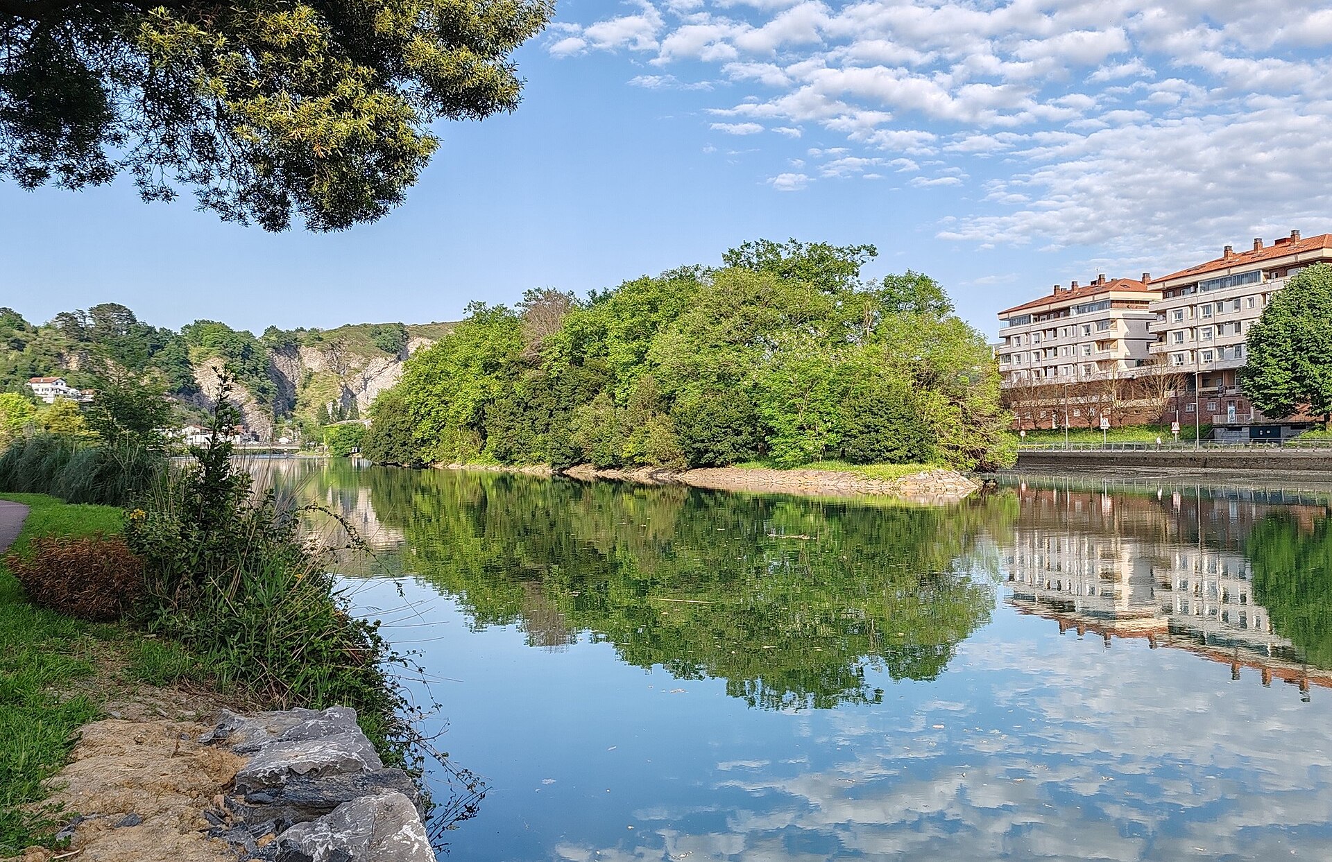
Pheasant Island might be the strangest territorial arrangement in the world.
It’s a tiny uninhabited river island barely 200 meters long and 40 meters wide sitting in the Bidasoa River on the border between Spain and France. It’s overgrown with trees and completely uninhabited. It has no buildings, no visitors and no public access. It’s in Basque Country near the towns of Irun on the Spanish side and Hendaye on the French side. .
What makes it unique is that sovereignty over the island alternates between the two countries every six months. Spain administers it from February to July and France takes over from August to January. Whichever country currently holds sovereignty is technically responsible for its maintenance, though in practice very little happens there. It’s the only place on earth where two countries take turns owning the same piece of land.
The arrangement dates back to the 1659 Treaty of the Pyrenees which was actually signed on the island itself. It was a neutral meeting ground chosen precisely because it belonged to neither side, and the alternating sovereignty arrangement was established at that time as a kind of permanent acknowledgment of that neutrality.
Find out more about the Spanish Lifestyle guide.